|
|
[[Neighborhood Data for Social Change]]
|
| The Neighborhood Data for Social Change (NDSC) platform is a free, publicly available online resource for civic actors to learn about their communities.
|
|
|

|
|
[[Open 988]]
|
| 988 has been designated as the new three-digit dialing code that will route callers to the National Suicide Prevention Lifeline. While some areas may be currently able to connect to the Lifeline by dialing 988, this dialing code will be available to everyone across the United States starting on July 16, 2022.
|
|
|
|
|
[[Open Data STREAMS]]
|
| This project involves an evaluation framework for open datasets published by the City of Portland. The goal is to create a data analysis tool which provides quality assurance for datasets made available between bureaus and to the public.
|
|
|

|
|
[[Open Network for Education and Skilling Transactions]]
|
| Beckn-based Open Network for Education and Skilling Transactions (ONEST)
|
|
|

|
|
[[Open Participatory Budgeting]]
|
| Participatory budgeting (PB) is process in which citizens decide how to allocate part of a municipal or public budget through a process of democratic deliberation and decision-making. Participatory budgeting allows citizens or residents of a locality to identify, discuss, and prioritize public spending projects, and gives them the power to make real decisions about how money is spent.
|
|
|

|
|
[[Open platform for scalable and multi-domain IoT applications for smart cities]]
|
Objectives
- To adopt FIWARE as a flexible framework to build multi domain Internet of Things applications.
- To prove the easy replicability of a FIWARE based IoT application on preventing environmental disasters deployed in Genoa, in another IoT application on smart smart parking needed in Milan.
- To prove the interoperability between an open platform deployed in Turin for implementing a waste management application and FIWARE.
|
|
|

|
|
[[OpenGrid]]
|
| OpenGrid is an interactive, map-based platform for exploring open data sets in an easy-to-use, map-based interface. OpenGrid enables municipalities to offer residents, businesses, and communities a better way to interact with public data. Users can perform advanced queries to filter data as well as search within custom boundaries or based on the user's location.
|
|
|

|
|
[[Oregon Data Catalog]]
|
| The Oregon Data Catalog is a platform for managing and publishing data sets that are relevant to the state of Oregon in the United States. The platform is based on CKAN, which is a free and open-source software platform for managing and publishing data.
|
|
|
|
|
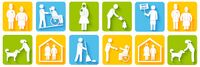
[[Personal Access System for Services (PASS)]]
|
| Social services are programs or services designed to support individuals and communities in need. They provide assistance with basic needs such as food, housing, and clothing, as well as health and medical care, education and job training, child care, support for individuals with disabilities or mental health conditions, and aging and elder care. These services are intended to improve the quality of life for individuals and communities and help individuals achieve self-sufficiency.
|
|
|
|
|
[[Personalized Dashboard for the Residents]]
|
| YoGov and the City of San Leandro partnered to create an Amazon-like dashboard for city residents, helping residents quickly and easily find services most relevant to them. The dashboard also promotes city services, events, and news that are important to the city.
|
|
|

|
|
[[PortlandMaps - Open Data]]
|
| PortlandMaps delivers site-specific property information, neighborhood crime statistics, aerial photos, school information, and tons of additional map data for the City of Portland and beyond.
|
|
|
|
|
[[Protecting user Data in the Smart City scenario]]
|
| Data is exchanged intensively within a Smart City, the correct usage of such information is vital to provide a better service to the citizens. Protecting user’s details is the key of a broader adoption of any application with intense data exchange and exploitation.
|
|
|

|
|
[[Resilience HUB - East Multnomah]]
|
| Resilience Hubs are community-serving facilities augmented to support residents and coordinate resource distribution and services before, during, or after a natural hazard event. They leverage established, trusted, and community-managed facilities that are used year-round as neighborhood centers for community-building activities. Resilience Hubs can equitably enhance community resilience while reducing greenhouse gas emissions and improving local quality of life for our communities. They have the potential to reduce burden on local emergency response teams, improve access to public health initiatives, increase the effectiveness of community-centered institutions and programs.
|
|
|

|
|
[[Saitama City Smart Community Project]]
|
| We developed a Smart Community Information Platform (SCIP) for achieving security and privacy management of smart city data and providing smart city data services considering time-, privacy-, and location- critical problems. We are implementing the information platform for providing smart town services for 32,000 residents in 230-hectare area of Misono Town, Saitama City as a testing site of SCIP.
|
|
|

|
|
[[Smart Beyoğlu: Digital Recollection of Beyoğlu]]
|
| Smart Beyoğlu is a mobile application project which provides fast access to all transactions related to the municipality and solutions for the citizens and business owners in Beyoğlu. Local and foreign tourists can get a lot of information such as details, location of business, hotels, restaurants etc., historical buildings and cultural events. It is a mobile app project that allows them to set up a network.
|
|
|

|
|
[[Smart Cities Dashboard in the City of Bellevue WA]]
|
Install a pilot GIS-based visual dashboard to provide improvements in the following sectors:
- Safety and security – provide greater coverage and more efficient deployment of emergency services
- Transportation – provide better street lighting and traffic control
- Operational efficiencies – improve efficiency of water distribution, energy efficiency in buildings, response times, and reduce costs
- Interactive citizen engagement – keeping residents and tourists better informed
- Improve communications and information sharing between departments
|
|
|

|
|
[[Smart City Vision Strategic Planning and Digital Transformation Methodology]]
|
* The Smart City methodology helps people imagine and learn about future state scenarios for their lives, businesses, and cities. The process produces clearly defined product solutions and projects they want to create, design, and implement.
- The methodology can be used to introduce people who have little to no knowledge about Smart Cities and facilitate learning experiences that create and build well-versed leaders who can drive, manage, and support Smart City initiatives. Digital Transformation aspects will include key performance indicators and checkpoints to ensure teams remain on course until goals and future vision are realized.
- We are submitting this methodology for consideration and use with the Education SuperCluster and Action Teams to help define what each group would like to create for the SuperCluster and how they want to interface with the existing SuperClusters to integrate and amplify existing knowledge within the GCTC.
|
|
|

|
|
[[SynchroniCity]]
|
| The opportunities presented by technology are endless. However, societies are still struggling to get long-lasting value out of it, contributing to local priorities. How do we ensure that technology respects our privacy, enables us to live in a more sustainable way and helps us lead a happier life? It has become clear that we need to rethink and improve our development of technology in order to create better living conditions for people. For this reason, we created SynchroniCity, opening up a global market, where cities and businesses develop IoT- and AI-enabled services through pilots to improve the lives of citizens and grow local economies.
|
|
|

|
|
[[Taipei Smart City Living Lab]]
|
* Taipei has been transformed into a living lab through the efforts of public-private partnership. The matchmaking mechanism efficiently solves city problems and citizen demands, as well as instantly promoting government plans and integrating private resources. It is a much more positive and comprehensive approach, compared to the methods adopted by other cities, promoting their projects either in a top-down or bottom-up fashion.
- Once this matching mechanism matures, Taiwan’s smart city industry will be in full motion and many solutions will be quickly copied by other international cities. At that point, Taipei will become a focal point for the smart city brand and best practice model.
|
|
|
|
|
[[Taoyuan Mobile Citizen Card]]
|
| In respond to the needs of mobile payment and the popularization of mobile devices, Taoyuan City Government works with telecom companies and e-ticket companies to integrate the citizen card into the sim card of a mobile phone so that citizens are allowed to enjoy all the functions and service of a citizen card on their phone such as borrowing books, taking trains/metros/buses, renting Ubikes, purchasing at a convenience store, accumulating bonuses, etc., and getting special discounts at certain stores. Citizens are thus given more options in ways to use their citizen cards.
|
|
|