San Francisco CA

- Members


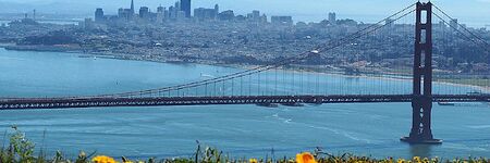
San Francisco officially the City and County of San Francisco, is a cultural, commercial, and financial center in the U.S. state of California. Located in Northern California, San Francisco is the 17th most populous city proper in the United States, and the fourth most populous in California, with 873,965 residents as of 2020. It covers an area of about 46.9 square miles (121 square kilometers), mostly at the north end of the San Francisco Peninsula in the San Francisco Bay Area, making it the second most densely populated large U.S. city, and the fifth most densely populated U.S. county, behind only four of the five New York City boroughs. San Francisco is the 12th-largest metropolitan statistical area in the United States with 4.7 million residents, and the fourth-largest by economic output, with a GDP of $592 billion in 2019. With San Jose, it forms the San Jose–San Francisco–Oakland, CA Combined Statistical Area, the fifth most populous combined statistical area in the United States, with 9.6 million residents as of 2019. Colloquial nicknames for San Francisco include SF, San Fran, The City, and Frisco.
Activities
|
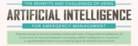
Clarity Amidst Chaos – How AI is Enhancing Emergency Preparedness | |
| SF Bay area Emergency Managers and One Concern have joined together to provide the power of AI to California emergency responders.
‘Seismic Concern’ uses artificial intelligence and state of art earthquake engineering research to provide emergency managers with damage maps and statistics in the immediate aftermath of a catastrophic earthquake, enhancing situational awareness required for rescue and relief efforts. Moreover, through the ‘Seismic Concern Training Module’, emergency operations centers will be able to design and train on realistic scenarios based on actual simulations to get a real sense of the situation. One Concern will demonstrate their capability to predict the extent of damage to personal residences, commercial and government building as well as other critical infrastructure in the immediate aftermath of an earthquake in the San Francisco Bay Area Region, as well as the capability of the training/simulation module to aid resiliency and mitigation efforts. SF DEM will demonstrate how One Concern’s technology will enhance immediate response and recovery efforts and will use their simulations to quantify mitigation efforts and develop accurate scenarios for emergency responders. | ||
|
Constituent-led Public Data and IoT Utility for Urban Health Housing and Environmental Hazard Management | |
Objectives
| ||
|
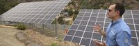
Microgrids Sustainable resilient mobile power for disasters | |
Deploy mobile, rechargeable power units throughout city departments to intelligently manage and measure energy usage. This can result in reduced energy costs through time shifting consumption from daytime to nighttime and peak shaving to lower demand charges. The mobile chargers would be remotely monitored and available to be deployed in the immediate aftermath of a catastrophe.
| ||

|
Risk Assessment and Prioritization in the Smart City Cyber Resilience Planning Process | |
| This use case summarizes an engagement between a GCTC Action Cluster member, Adaptable Security Corp (ADA), and a California municipality, focusing on how the risk management process, with a particular focus on risk assessment and prioritization, played a critical role in the overall cyber resilience planning process. The content covered in this use case primarily aligns with the Prepare, Select, Assess, and Monitor steps of the RMF. | ||
| Urban Mobility Transit Portal for 511 org | ||
| The goal was to build a new 511.org site to meet the growing demands of urban mobility commuters in the San Francisco Bay Area. 511.org should be the ultimate destination for commuters to plan their route to have the easiest time getting to their destination. 511.org should also incorporate all of the available data across transit agencies and systems into this single destination. | ||