Low-cost Air Quality Monitoring RAMPs in Pittsburgh PA
| Low-cost Air Quality Monitoring RAMPs in Pittsburgh PA | |
|---|---|

| |
 Real Time, Multi-Pollutant Sensors | |
| Team Organizations | Carnegie Mellon University City of Pittsburgh Allegheny County PA |
| Team Leaders | Albert Presto R Subramanian |
| Participating Municipalities | Pittsburgh PA Allegheny County PA |
| Status | Development |
| Document | None |
Description
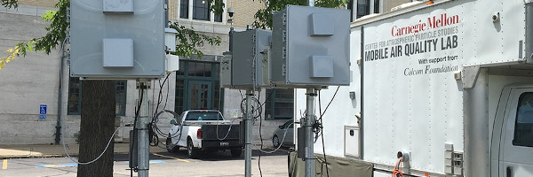
The proposed project will deploy 30 Real Time, Multi-Pollutant Sensors (RAMPs) at traffic intersections currently managed by the Scalable Urban Traffic Control (SURTRAC) Intelligent Traffic control system, an adaptive traffic control system that optimizes traffic flows in the East Liberty corridor of Pittsburgh (see figure below). These RAMP sensors are portable, low-cost sensors for gaseous air pollutants and particulate matter (PM) that have been developed at Carnegie Mellon and will be mounted on utility poles, using the access already provided by SURTRAC for their equipment.
The existing SURTRAC architecture in East Liberty provides an important platform to study urban air quality through unprecedented approaches that could be replicated across city neighborhoods and which could eventually be scaled across the Pittsburgh metropolitan region. No other system like this currently exists.
Challenges
We have extensively characterized the RAMP performance in the laboratory and at a test site adjacent to our campus. This project represents the first wide-scale, distributed, long-term (>1 year) deployment of RAMPs. In the near term we may encounter logistical challenges associated with maintenance. In the longer term (> 6 months – 1 year), we will need to track performance of the electrochemical sensors used to measure gaseous pollutants. The individual sensor elements will eventually need to be replaced periodically as part of routine maintenance.
Solutions
TBD
Major Requirements
- First, the team will develop and test low-cost air quality sensor packages. The first generation of the sensor package has been produced and is being deployed for testing on Carnegie Mellon campus.
- The team will work with the existing SURTRAC Intelligent Traffic control system in the East End to mount the 30 sensors on utility poles, using the access already provided by SURTRAC for their equipment.
- The team will leverage the existing SURTRAC computers installed at the traffic intersections to export data via the serial connection, or data will be transferred over the cellular network by a GSM modem.
- A data management framework will handle data streams captured by the sensor network. This framework will also provide an interface for applications to access and analyze this rich dataset about the city. Data will be made available in its raw form as received from the sensors, as well as in a "cleaned" form that is processed after it arrives to remove anomalies or aberrations in the data (e.g., due to sensor noise or sensor failures).
- Data analysis and visualization will be conducted to develop a traffic control strategy to minimize pollutant levels, produce publicly hosted maps, and provide localized pollutant reports.
Performance Targets
| Key Performance Indicators (KPIs) | Measurement Methods |
|---|---|
|
We can conduct a simple, controlled experiment: investigate air pollutant concentrations with the traffic management system turned off versus on. The distributed nature of the RAMP sensors will allow us to quantify the positive air quality impacts of active traffic management both temporally and spatially. Key metrics to accomplish for this goal will be the installation of 30 RAMP sensor packages on the SURTRAC backbone and successful completion of an experiment comparing air quality with and without actively managed traffic. |
Standards, Replicability, Scalability, and Sustainability
The deployment of RAMPs at SURTRAC controlled intersections will be scalable both within Pittsburgh and to other cities. This project will build the software to incorporate distributed air quality data into future deployments of SURTRAC or similar systems. Future investments will therefore require additional hardware, but no additional software.
Cybersecurity and Privacy
TBD
Impacts
Ultimately, results of this air quality research described below will also allow us to do the following:
- Perform air quality mapping using sensor data to create publicly hosted maps so anyone could see them in real time and make decisions about where to walk, bike, etc.;
- Use air quality data to develop a traffic control strategy that minimizes pollutant levels;
- Monitor specific neighborhoods to quantify the excess air pollution burden;
- Provide detailed and localized pollutant reports and link them to other public health data over time (indoor air quality information, 911 calls, emergency room or doctor visits, hospital admissions);
- Target areas for enforcement, where a dense network of sensors allow authorities to identify short-term compliance issues (e.g., bad emissions from a factory) or to help troubleshoot odor complaints (e.g., people burning wood), thereby enabling rapid identification and response;
- Inform and update community groups on a continuous basis.
With coupled air quality data from the RAMPs, it may be possible – in a set of future activities outside this proposal – to develop control algorithms designed to minimize concentrations of specific pollutants. These control algorithms could be deployed over the entire test bed (e.g., minimize CO in the whole domain), or in certain subsets of the domain (e.g., minimize CO at the 10 most polluted intersections).
Demonstration/Deployment
- Phase I Pilot/Demonstration:
This project will run for two years. While the basic design of the sensor package is complete, time will be required to make the required modifications and to manufacture the sensors. This activity is expected to take three to six months, after which time the 30 RAMPs will be installed at selected intersections.
- Phase II Deployment:
Testing will begin in the second year with community meetings held six months after the start of testing, and at the end of two years.