East Portland Resilient Island Vision Plan
| East Portland Resilient Island Vision Plan | |
|---|---|
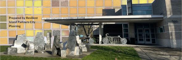
 East Portland Community Center | |
| Team Organizations | RIP City Planning |
| Team Leaders | Blair Vallie |
| Participating Municipalities | Portland OR |
| Sectors | Public Safety Resilience |
| Status | Master Planning |
| Last Updated | April 27, 2024 |
Summary
To execute the East Portland Resilient Island Project, RIP City Planning has partnered with Portland’s Disaster Resilience and Recovery Action Group (DRRAG), an organization composed of representatives from Portland Bureaus of Development Services, Emergency Management, Environmental Services, Water, Planning and Sustainability, Transportation, and Parks & Recreation, as well as Portland State University’s Institute for Sustainable Solutions.
DRRAG and RIP City Planning see this project as a prime
opportunity to better understand and enhance the East
Portland Community Center's role in fostering social
connectivity and community-level disaster planning. Through
abundant engagement efforts with local community groups
and EPCC patrons, we aim to co-create a community-led
document reenvisioning EPCC as the center of a 'resilient
island' during disaster events and non-emergency times.
What is our Area of Study and Why?
We limited the focus of this project to the area within an approximately 15-minute walk of the East Portland Community Center. The concept of focusing on the built environment and services within this area is common in urban planning, and allows for assessing the accessibility and social orientation of neighborhoods. We have merged that concept with the practical consideration that in a serious disaster scenario, such as a severe earthquake, people may not be able to use transit or roadways to reach EPCC, and may instead need to travel by foot or bike.
WhatHazards arewe Talking about?
Portlanders face a variety of natural hazards, including earthquakes, landslides, flooding, and extreme heat. This project focuses specifically on hazards that are both highly likely to occur in East Portland, and will have a relatively high impact when they do:
- Earthquakes: The Pacific Northwest region is vulnerable
to impacts from the impending Cascadia Subduction Zone earthquake, as well as smaller and more frequent tremors.
- Extreme Temperatures: The effects of climate change are
likely to amplify the frequency and severity of extreme temperature events in Oregon.
- Wildfire Smoke: Portland is surrounded by forests, which
in recent years have seen an alarming uptick in massive wildfires. The smoke from these wildfires poses severe threats to the health and well-being of Portlanders
What Role does EPCC Serve inCrises?
EPCC currently plays an important role in official responses to hazards facing East Portland communities. In 2020, EPCC coordinated with Multnomah County to serve as a shelter for wildfire evacuees. It has also served as a community COVID19 vaccination site, and it can be activated as both a cooling and warming center. In non-disaster times, the center provides services and resources to houseless individuals, working in partnership with community organizations and Multnomah County to provide temporary shelter.