Next Generation Resilient Warning Systems for Tornados and Flash Floods
| Next Generation Resilient Warning Systems for Tornados and Flash Floods | |
|---|---|

| |
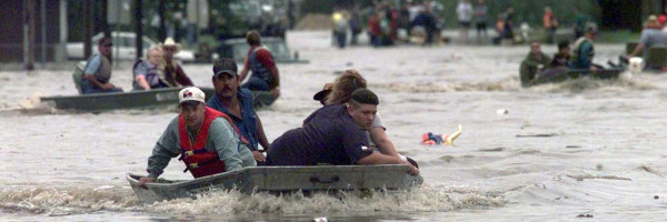
 Flash Flood Texas | |
| Team Organizations | University of Massachusetts Colorado State University North Central Texas Council of Governments |
| Team Leaders | Michael Zink Brenda Philips Apoorva Bajaj Venkatachalam Chandrasekar |
| Participating Municipalities | North Central Texas Council of Governments City of Midlothian TX City of Fort Wort TX |
| Status | Implemented |
| Document | None |
Description
The project aims to revolutionize severe weather warnings through Next Gen communications and networking. Focusing on hyper-local, user-driven, context-aware alerts, it leverages mobile phones and hyper-local data for customized warnings, enhancing response and outcomes.
Challenges
- Affordable, high-bandwidth uplinks for high resolution radars
- Infrastructure failures during severe weather events
- Prioritization of warning information delivery based on socio-environmental risk
- Provision of warning information to individuals in vehicles
- Provision of warning information that triggers appropriate user behavior
Solutions
- Next Gen communications/networking for delivery of hyper-local, user driven, context aware severe weather warnings.
- Mobile phones and hyper-local data enable customization to improve response and outcomes
- Development of communication, networking and warning concepts benefits from live experimentation and user co-creation
- CASA has established a Living Lab for Severe Weather Warning with an end-to-end warning infrastructure from radars to the public.
- Cities are facing greater vulnerability due to increasing population concentration and frequency/severity of storms
Major Requirements
- Build a weather warning system that ingests information from sensors and forecasts
- Build a smartphone app that enables targeted alerts based on user context
- Create models for the implementation of (radar) sensor networks for public safety and economic benefit
- Design these networks based on new cloud computing and software defined networking technologies
- Create a “plug and play” platform for technology innovations
- Evaluate system with real weather and real users
- Evaluate how SDX/SDI can support this system
Performance Targets
| Key Performance Indicators (KPIs) | Measurement Methods |
|---|---|
|
|
Standards, Replicability, Scalability, and Sustainability
- Establish new standards for prioritized communication of weather warnings
- Establish common language for communication of high precision warnings in conjunction with NWS, Emergency Managers, and the general public
- Engagement of major vendors (radar manufacturers) and National Weather Service in the project to establish common standards.
- The CASA Urban Demonstration Testbed in the Dallas/Fort Worth Metroplex could be seen as a model for other major US cities
Cybersecurity and Privacy
TBD
Impacts
This project has the potential to save lives and property in the case of severe weather events through the delivery of geographically targeted, user defined alerts to users on mobile phones through custom designed app. This system will provide essential information to mobile users in severe weather events based on context.
Demonstration/Deployment
A testbed of currently 7 radars is already deployed in the DFW Metroplex and cities like Fort Worth and Midlothian use data generated by the system for their emergency management operations.
- Phase I Pilot/Demonstration:
- Focus groups and surveys on public to determine prioritized warning delivery and messages.
- Evaluations of socio-technical risk.
- Demonstration of operations during past severe weather events in DFW.
- Phase II Deployment:
- Deployment of communications/networked system in Dallas Metroplex leveraging DFW Living lab infrastructure of 8 networked radars, that produce severe weather warnings on mobile phones of participating individuals (200+ general public participants, 20-50 Emergency managers, private sector evaluators from local airports, hospitals) and on systems used by the National Weather Service.