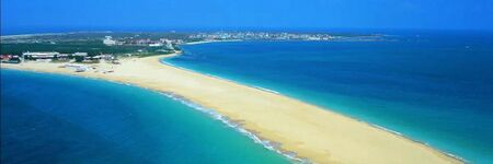
Penghu Taiwan
- Members
The Penghu or Pescadores Islands are an archipelago of 90 islands and islets in the Taiwan Strait. The largest city is Magong, located on the largest island, which is also named Magong. Covering an area of 141 square kilometers (54 sq mi), the archipelago collectively forms Penghu County of the Republic of China (Taiwan) and is the smallest county of Taiwan Province after Lienchiang County (the Matsu Islands) of the Fujian Province.
Activities

|
Low Carbon Island and Smart Bay Project | |
| Penghu County is located on the central point of Taiwan Strait. The population of Penghu is 103, 000 in 2017 and there are about 1 million tourists visit Penghu per year. Since 2011 Penghu implemented the Low Carbon Island project and now will start the following second phase from 2018 to 2021. This project includes solar and wind power renewable energy development, offshore wind farm investment, smart grid system, electric vehicle, water and energy management system of small island and smart transportation service. | ||

