Baltimore MD
- Members
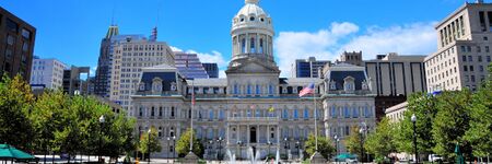
Baltimore is the most populous city in the U.S. state of Maryland, as well as the 30th most populous city in the United States, with a population of 585,708 in 2020. Baltimore was designated an independent city by the Constitution of Maryland in 1851, and today is the largest independent city in the United States. As of 2017, the population of the Baltimore metropolitan area was estimated to be just under 2.802 million, making it the 21st largest metropolitan area in the country.[11] Baltimore is located about 40 miles (64 km) northeast of Washington, D.C., making it a principal city in the Washington–Baltimore combined statistical area (CSA), the third-largest CSA in the nation, with a calculated 2018 population of 9,797,063.
Activities

|
Baltimore Community Resilience Hub | |
| Baltimore is highly vulnerable to a range of natural hazards, including coastal storms, flooding, extreme heat, and high winds. These types of extreme events are likely to increase in frequency and magnitude over the coming years. These natural hazards, combined with exacerbated influences of climate change, create impacts that will affect the City’s residents, businesses, infrastructure, and natural systems, and threaten regionally significant assets. | ||

|
Maryland Digital ID Integration Project | |
| The Maryland Department of Transportation Motor Vehicle Administration (MDOT MVA) has announced the availability of Maryland Mobile ID in Samsung Wallet, making Maryland the second state in the U.S. to offer digital licenses on this platform. This initiative allows Marylanders to securely verify their identity at select TSA PreCheck airport checkpoints, including Baltimore/Washington International Thurgood Marshall Airport and Ronald Reagan Washington National Airport. With this launch, Maryland becomes the first state to provide digital ID integration across Samsung Wallet, Apple Wallet, and Google Wallet. More than 200,000 Maryland residents have already adopted digital IDs since their introduction in 2022. Maryland Mobile ID serves as a secure and convenient companion to physical IDs, emphasizing privacy and safety with robust hardware and software security measures. For details on setup and usage, visit the MVA website. | ||

|
My Digital Data Locker Baltimore | |
| For those staying in a shelter or shuttling between other people’s homes, keeping track of these vital documents can be near impossible. They also can be lost, destroyed or stolen.
Recognizing that this was blocking some people from securing stable housing, the city of Baltimore this year launched an innovative program — My Digital Data Locker — to help people store and keep track of key documents. | ||

|
Smart Transit Hubs - B Smart | |
Pilot a smart street light corridor within a system of transit “super-nodes” developed by transforming current major transit stations into transit hubs (Hubs) defined by:
| ||

|
Smart Waste Management & Logistics: Ecube Labs | |
Objectives
| ||

|
How Open-Source Software Makes Cities More Livable | |
| St. Francis is now rolling out a new calendaring and scheduling service on its website, designed to help neighborhood people register for services or reserve space for events. | ||

|
Launch of My Digital Data Locker Baltimore | |
| Baltimore’s Continuum of Care (CoC) have launched My Digital Data Locker Baltimore – a web-based tool that gives people experiencing homelessness a secure place to manage digital copies of vital documents needed to obtain housing services. | ||


