Cambridge UK
- Members
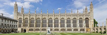
Cambridge is a university city and the county town of Cambridgeshire, England, on the River Cam approximately 55 miles (89 km) north of London. At the United Kingdom Census 2011, the population of the Cambridge built-up area (which is larger than the remit of Cambridge City Council) was 158,434 including 29,327 students. Cambridge became an important trading centre during the Roman and Viking ages, and there is archaeological evidence of settlement in the area as early as the Bronze Age. The first town charters were granted in the 12th century, although modern city status was not officially conferred until 1951.
Activities

|
Citizen App | |
| Citizen App, the first of its kind, empower individuals to claim and legally own their data from across multiple sources, then use it securely and seamlessly in everyday life. | ||

|
Hub of All Things | |
| The Hub of All Things (HAT) Microserver is a pioneering digital infrastructure that enables individuals, businesses, and organizations to take control of their personal data through self-sovereign data management. Built on over $50 million of UK research, the HAT Microserver separates data storage from application services, granting users full legal ownership of their data, even if it was generated by external entities like banks or hospitals. This technology transforms personal data into a new asset class known as "self-sovereign data," which retains intellectual property (IP) rights for the data producers, allowing them to safely and securely create value from it. Hosted by Dataswyft, the HAT Microserver is cloud-native, portable, and open-source, with pending patents for its deployment and protocols for data governance, offering a more secure, efficient, and governed approach to managing personal and organizational data in a decentralized environment. | ||

|
Creating City Portraits | |
| This guide provides a City Portrait methodology available to all who are interested in downscaling Doughnut Economics to their city or place. The guide is an effort to make it as simple and straightforward as possible for everyone to do. | ||


