State of Place City of Tigard: Difference between revisions
No edit summary |
No edit summary |
||
| Line 16: | Line 16: | ||
Partnering with State of Place, Tigard was able to not only increase walkability, but also forecast: | Partnering with State of Place, Tigard was able to not only increase walkability, but also forecast: | ||
[[File:StateofPlaceScreenShot.png| | [[File:StateofPlaceScreenShot.png|600px]] | ||
[[File:StateofPlaceWalkability.png| | [[File:StateofPlaceWalkability.png|600px]] | ||
Revision as of 19:31, November 12, 2023
| State of Place City of Tigard | |
 City of Tigard | |
| Team Organizations | State of Place City of Tigard |
| Point of Contact | Lloyd Purdy |
| Participating Municipalities | Tigard OR |
| Sectors | Wellbeing |
| Initiative | |
| Status | Implemented |
| Last Updated | December 18, 2025 |
Summary
Prior to using State of Place, Tigard did not know where to begin in their data-driven walkability plan for their Tigard Triangle project. The process was cumbersome and error-prone. The City needed a tool that could conduct objective, robust assessments of existing walkability of the Tigard Triangle, and offer impactful recommendations to increase public approval.
Solution
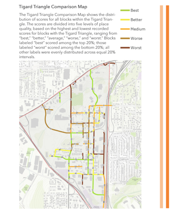
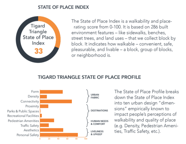
Tigard was able to quantify the impacts of various development and planning proposals with respect to walkability, having employed State of Place’s all-in-one tool. The City ran the State of Place Index and Profile for every block in the Triangle, which also helped them identify specific geographic areas in which they should intervene. This was later applied in the Downtown, in order to have a local basis of comparison. Ultimately, Tigard, collaborating with State of Place, prioritised urban design improvements most likely to boost walkability and economic development.
Result
Partnering with State of Place, Tigard was able to not only increase walkability, but also forecast:

