Multi-modal Trip Planner: Difference between revisions
No edit summary |
No edit summary |
||
| Line 10: | Line 10: | ||
|summary=Develop a tool enables commuters to plan trips encompassing public transit, ride-sharing services, bike rentals, and pedestrian routes. By integrating multiple modes of transportation, this enhanced trip planner aims to make commuting more seamless and convenient, empowering individuals to choose sustainable alternatives to private vehicles. | |summary=Develop a tool enables commuters to plan trips encompassing public transit, ride-sharing services, bike rentals, and pedestrian routes. By integrating multiple modes of transportation, this enhanced trip planner aims to make commuting more seamless and convenient, empowering individuals to choose sustainable alternatives to private vehicles. | ||
}} | }} | ||
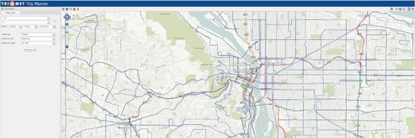
The project was designed to enhance the existing TriMet trip planner to include shared-use mobility (SUM) options[[CiteRef::MODSandbox]], real-time information on transit vehicle arrivals, pedestrian routing in consideration of sidewalks, and other interface or data enhancements. This project significantly improves transit trip planning by including more modes and enhancing mapping, geocoding, and spatial data, accomplished using open source software, which minimizes up-front cost and delay for other systems to start their own multimodal trip planner. It also provided strategic planning that answers critical questions for future implementation of paying for a multimodal trip. The project had four main goals: | The project was designed to enhance the existing TriMet trip planner to include shared-use mobility (SUM) options[[CiteRef::MODSandbox]], real-time information on transit vehicle arrivals, pedestrian routing in consideration of sidewalks, and other interface or data enhancements. This project significantly improves transit trip planning by including more modes and enhancing mapping, geocoding, and spatial data, accomplished using open source software, which minimizes up-front cost and delay for other systems to start their own multimodal trip planner. It also provided strategic planning that answers critical questions for future implementation of paying for a multimodal trip. The project had four main goals: | ||
#for the OpenTripPlanner (OTP), extend code to incorporate shared-use mobility (SUM) modes, real-time information, and enhanced accessibility narrative, #for the Pelias geocoder, extend functionality for government agencies and improve match rate and accuracy of locations, | #for the OpenTripPlanner (OTP), extend code to incorporate shared-use mobility (SUM) modes, real-time information, and enhanced accessibility narrative, #for the Pelias geocoder, extend functionality for government agencies and improve match rate and accuracy of locations, | ||
Revision as of 15:47, May 18, 2023
| Multi-modal Trip Planner | |
 Multi-modal Trip Planner | |
| Team Organizations | TRIMET IBI Group Conveyal Pelias Oregon Metro moovel University of South Florida Fehr & Peers |
| Point of Contact | Bibiana McHugh |
| Participating Municipalities | Portland OR |
| Sectors | Transportation |
| Initiative | |
| Status | Launched |
| Last Updated | December 15, 2025 |
Summary
Develop a tool enables commuters to plan trips encompassing public transit, ride-sharing services, bike rentals, and pedestrian routes. By integrating multiple modes of transportation, this enhanced trip planner aims to make commuting more seamless and convenient, empowering individuals to choose sustainable alternatives to private vehicles.
The project was designed to enhance the existing TriMet trip planner to include shared-use mobility (SUM) options1, real-time information on transit vehicle arrivals, pedestrian routing in consideration of sidewalks, and other interface or data enhancements. This project significantly improves transit trip planning by including more modes and enhancing mapping, geocoding, and spatial data, accomplished using open source software, which minimizes up-front cost and delay for other systems to start their own multimodal trip planner. It also provided strategic planning that answers critical questions for future implementation of paying for a multimodal trip. The project had four main goals:
- for the OpenTripPlanner (OTP), extend code to incorporate shared-use mobility (SUM) modes, real-time information, and enhanced accessibility narrative, #for the Pelias geocoder, extend functionality for government agencies and improve match rate and accuracy of locations,
- for OpenStreetMap and OpenAddresses, improve data to support new and enhance existing features for comprehensive trip planning and geocoding, and
- develop an Integrated Payment Plan for a future one-click payment feature by using existing software and data and leveraging open source software, open data, and open standards to facilitate widespread adoption and easy replicability for other transit agencies.
TriMet partnered with five transit agencies to ensure that project requirements were inclusive and comprehensive.
OpenTripPlanner
OpenTripPlanner (OTP) is a family of open source software projects that provide passenger information and transportation network analysis services. The core server-side Java component finds itineraries combining transit, pedestrian, bicycle, and car segments through networks built from widely available, open standard OpenStreetMap and GTFS data. This service can be accessed directly via its web API or using a range of Javascript client libraries, including modern reactive modular components targeting mobile platforms.
References
- ^ Tri-County Metropolitan Transportation District of Oregon. "Mobility on Demand (MOD) Sandbox Demonstration: Tri-County Metropolitan Transportation District of Oregon (TriMet) OpenTripPlanner (OTP) Shared-Use Mobility, Final Report".
 , Not Available, 2021, DOI = 10.21949/1520683.