Independence OR
Jump to navigation
Jump to search

- Members
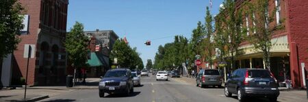
Independence is a city in Polk County, Oregon, United States, on the west bank of the Willamette River along Oregon Route 51, and east of nearby Monmouth. It is part of the Salem Metropolitan Statistical Area. Thirty square blocks of the oldest part of Independence form the National Register of Historic Places-listed Independence Historic District.
The population was 8,590 at the 2010 census.
Activities

|
Farm to Fork Crop Tracking | |
| Tracking a berry crop at the box, bin, or tote level from harvest in the field to end user. Monitor in near real time temperature, humidity, shock and other environmental conditions to ensure product quality after harvest, throughout transit and during storage. Potential to use blockchain to ensure authenticity of food safety certification which can travel with each sensor. | ||
|
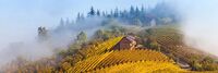
Microclimate Prediction for Willamette Valley Vineyards | |
| Leveraging regional weather data and weather stations at individual vineyards to develop a regional prediction for when bud break and bloom will happen as well as highly specific predictions of those same dates for individual vineyards. Additional opportunities to predict and develop alerts for freezes, powdery mildew, and other events targeted at specific vineyards. | ||