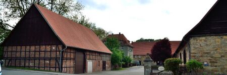
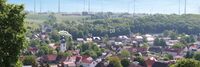
Borchen-Etteln
- Members
Borchen in its current form has only existed since 1969. Its predecessors were governed by the Roman Catholic Archdiocese of Paderborn.
Activities
|
Digital Strategy Borchen-Etteln | |
| To further increase the quality of life for all people in Borchen-Etteln and to develop the economic, social and ecological potential. In doing so, we take into account the interests of all age groups | ||
Details
In the 14th century the Bishopric of Paderborn was formed, which in turn became part of the Lower Rhenish-Westphalian Circle from the 16th century onward. From 1802 until 1807 the Bishopric was occupied by the Kingdom of Prussia, whereafter it fell to the Kingdom of Westphalia. In 1813 this kingdom fell apart, and in 1815 the Prussian Kingdom reoccupied the area. In this period Prussia instituted new administrative divisions which, in a modified form, can still be found today.
Thus the area became a member of the newly founded administrative district of Minden in the Province of Westphalia. In 1816, in the process of forming the new Districts of Germany, Alfen, Nordborchen, Kirchborchen and Dörenhagen were integrated into the district of Paderborn, whereas Etteln became a member of the Büren (district)|district of Büren.
In 1969, the municipalities Alfen, Nordborchen and Kirchborchen merged, forming the municipality of Borchen. Finally, on January 1, 1975, Etteln and Dörenhangen joined Borchen.