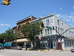
Westminster MD
| Westminster MD | |
|---|---|
 | |
| Main Street | |
| Seal | |
| Westminster MD Map | |
| Type of Municipality | City |
| Date Established | 1764 |
| Area | 6.656.65 sq.mi <br />17.223 sq.km <br />4,256 Acres <br />17,223,433.5 sq.meter <br />185,402,000 sq.ft <br /> |
| Elevation | 764764 ft <br />232.867 m <br /> |
| Population | 2012620,126 people <br /> |
| Timezone | EST |
- Members
Westminster is a city in northern Maryland, United States. A suburb of Baltimore, it is the seat of Carroll County. The city's population was 18,590 at the 2010 census. Westminster is an outlying community within the Baltimore-Towson, MD MSA, which is part of a greater Washington-Baltimore-Northern Virginia, DC-MD-VA-WV CSA.
Activities

|
MAGIC Smart Home Smart Community Project | |
| Install sensors and an in-home intelligent integration platform to demonstrate telemedicine features in a medically vulnerable group home setting; connected by Software Defined Networking (SDN) to other interested community partners utilizing the Westminster Fiber Network, to create the fundamental operational unit of a truly Smart Community. | ||
