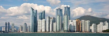
Busan Korea
|
|
Busan Korea Skyline
|
|
|
Seal
|
Loading map... {"minzoom":false,"maxzoom":false,"mappingservice":"leaflet","width":"450px","height":"250px","centre":false,"title":"","label":"","icon":"","lines":[],"polygons":[],"circles":[],"rectangles":[],"copycoords":false,"static":false,"zoom":10,"defzoom":14,"layers":["OpenStreetMap"],"image layers":[],"overlays":[],"resizable":false,"fullscreen":false,"scrollwheelzoom":true,"cluster":false,"clustermaxzoom":20,"clusterzoomonclick":true,"clustermaxradius":80,"clusterspiderfy":true,"geojson":"","clicktarget":"","imageLayers":[],"locations":[{"text":"\u003Cb\u003E\u003Cdiv class=\"mw-parser-output\"\u003E\u003Cp\u003EBusan Korea\n\u003C/p\u003E\u003C/div\u003E\u003C/b\u003E\u003Cdiv class=\"mw-parser-output\"\u003E\u003Cp\u003EBusan Korea\n\u003C/p\u003E\u003C/div\u003E","title":"Busan Korea\n","link":"","lat":35.1799528,"lon":129.0752365,"icon":""}],"imageoverlays":null}
|
Busan Korea Map
|
Type of Municipality
|
City
|
Date Established
|
1500
|
Area
|
770.04 sq.km297.314 sqmi <br />297.314 sq_mi <br />297.314 sq.mi <br />190,280.889 Acres <br />
|
Elevation
|
9898 ft <br />29.87 m <br />
|
Population
|
34118293,411,829 people <br />
|
Timezone
|
|
- Members
Busan (Korean pronunciation: [pu.sa̠n]), officially known as Busan Metropolitan City, is South Korea's second-most populous city after Seoul, with a population of over 3.4 million inhabitants. Formerly romanized as Pusan, it is the economic, cultural and educational center of southeastern South Korea, with its port—Korea's busiest and the sixth-busiest in the world. The surrounding "Southeast Economic Zone" (including Ulsan and South Gyeongsang) is South Korea's largest industrial area.
Activities
|
|
Busan Smart City
|
Key Deliverables
- To scan vehicles and pedestrians using video cameras which are embedded in street lights and vehicle detecting sensors
- To prevent car accident in school zone by giving alarm sign to cars and pedestrians using digital signage and ground LED light devices
- In case of violating stop line, Reporting services to a related government agencies
- To transform street lights into service node by replacing them with LEDs that have control node with various sensors, CCTV and communication modules
|
|
|
|
IoT and AI based Smart Energy Management System for Smart City
|
IoT & AI based Smart Energy Management Platform was deployed in public buildings in Suwon City to provide optimal management building facilities, environment, and energy using the urban 3D map and 3D spatial modeling. With the M&V (Measurement & Verification) engine using a standard algorithm, IPMVP (International Performance Measurement and Verification Protocol) as well as data intelligence technology with deep-learning, the platform can quickly measure energy performance and determine energy efficiency.
|
|
Details