Surrey BC: Difference between revisions
Jump to navigation
Jump to search
Created page with "{{Infobox municipality |municipality= City |established = 1879 |image = |image_caption = |image_seal = City of Surrey logo.png |area = 316.11 sq.km |elevation = 134 ft |popu..." |
(No difference)
|
Revision as of 03:54, April 20, 2022
| Surrey BC | |
|---|---|
| [[File:|center|450px|x150px|link=http://surrey.ca/]] | |
| Seal | |
| Surrey BC Map | |
| Type of Municipality | City |
| Date Established | 1879 |
| Area | 316.11 sq.km122.051 sq.mi <br />78,112.425 Acres <br />316,110,000 sq.meter <br />3,402,772,520.357 sq.ft <br /> |
| Elevation | 134 ft40.843 m <br /> |
| Population | 568,322568,322 people <br /> |
| Timezone | [[Has timezone::PDT]] |
- Members
Surrey is a city in the province of British Columbia, Canada, located south of the Fraser River and north of the Canada–United States border. It is a member municipality of the Metro Vancouver regional district and metropolitan area. Mainly a suburban city, Surrey is the province's second-largest by population after Vancouver and the third-largest by area after Abbotsford and Prince George. Seven neighbourhoods in Surrey are designated town centres: Cloverdale, Fleetwood, Guildford, Newton, South Surrey, and City Centre encompassed by Whalley.
Activities
|
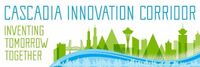
Cascadia Innovation Corridor | |
Municipal, academic, corporate and federal smart city activities are being coordinated across Portland, Seattle and Vancouver BC through the integration of several regional initiatives:
| ||