Template:Show activity
Jump to navigation
Jump to search

|
Boring Company Las Vegas Convention Center Loop | |
| The LVCC Loop system — a three-station transportation system consisting of 1.7 miles of tunnel — was built in approximately one year (using the now-legacy Godot Tunnel Boring Machine). LVCC Loop's cost was approximately $47M (firm fixed pricing) for the two tunnels and three stations (two surface and one subsurface). Tunneling occurred during large conventions (>100,000 attendees pre-COVID) with zero road closures and zero attendee disturbances. | ||
|
Building an Open Data Ecosystem | |
| The "Building an Open Data Ecosystem" project in Leeds, United Kingdom aims to foster collaboration and innovation through the development of an open data ecosystem in the city. | ||
|
CIVIC school HUBS | |
| NSF CIVIC grant to incubate the Federal School Infrastructure Toolkit for more resilience Community services. A pilot program with be developed with the BENSON school district in Portland, and woven into the urban/rural network of the Metro regional emergency response. | ||

|
Central Data Management System | |
| The 'Central Data Management System' project in Vienna, Austria aims to establish a comprehensive and efficient data management framework for the city. Led by the City of Vienna's Department of Data Management, the project seeks to centralize data storage, ensure data quality and security, and streamline data access and sharing processes. | ||

|
Citizen App | |
| Citizen App, the first of its kind, empower individuals to claim and legally own their data from across multiple sources, then use it securely and seamlessly in everyday life. | ||
|
City of Boston GoHubs | |
| A majority of our residents rely upon public transit, biking, walking, and driving to get around our city. But, shared mobility and technology advances are altering travel. New ways of transportation are introduced each day. The future of transportation may very well be shared, electric, and highly mobile. GoHubs! are intended to help us organize these modes. We provide information on how to access them and navigate the technology, and ultimately make it easier to get around Boston | ||
| Data.gov | ||
| Data.gov is a website operated by the U.S. federal government that provides access to datasets and other resources related to government activities and policies. It is intended to make government data more easily accessible to the public, with the goal of increasing transparency and enabling citizens to better understand and engage with their government. Data.gov offers a wide variety of data sets and resources, including data on topics such as agriculture, education, energy, finance, health, and more. The website also includes tools and resources for developers, such as APIs and code libraries, to help people use the data in creative and innovative ways. | ||
|
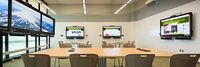
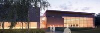
Decision Theatre PSU | |
| Portland State University’s Decision Theater is designed for university researchers and regional stakeholders (i.e. government, private companies) to work on projects that “link data sets, visualization and decisions,” according to a university statement. The space is modeled after Arizona State University's Decision Theater, as well as a similar facility at the University of Chicago. | ||

|
Dwellingly | |
| Dwelling.ly is an app to improve communication between the landlord providing transitional housing and the social workers who support them. | ||

|
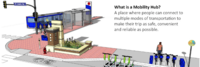
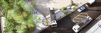
Electric Mobility Hub Demonstration | |
| An inviting & equitable community space that showcases electric mobility, integrates the street to the neighborhood, and serves as a model for future hubs. | ||
|
Eton College Energy Station | |
| The installation of an innovative renewable "Energy Station" is helping GRAHAM to reduce its carbon footprint and power demands at Eton College. | ||
|
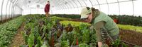
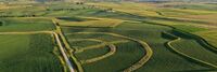
Farm to Fork Crop Tracking | |
| Tracking a berry crop at the box, bin, or tote level from harvest in the field to end user. Monitor in near real time temperature, humidity, shock and other environmental conditions to ensure product quality after harvest, throughout transit and during storage. Potential to use blockchain to ensure authenticity of food safety certification which can travel with each sensor. | ||
|
GIS Resources from the Oregon Department of Forestry | |
| Oregon Department of Forestry's GIS Data is maintained by the Information Technology Department's GIS Unit. | ||
|
Go-Green | |
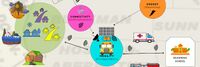
| GoGreen aims to help people understand the impact of small sustainable gestures on their communities through technology. It presents itself as a community rewards system where participating points providers can define actions that support their communities objectives and reward people for taking them. For the users they see a marketplace of options along with rewards based on secure blockchain based smart contracts for supportive behavior. | ||

|
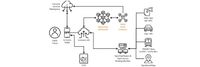
I3 Consortium Action Cluster | |
| The I3 project is creating a tool that will allow independent device owners to directly manage how the data streams from their IOT devices are delivered to applications. Opensource Project software includes support for privacy, trust, and incentive management.
Requirements and proof-of-concepts complete. Consortium management structure in process. Demonstration systems in process. R1.0 beta software in design. | ||
|
Indoor GPS-denied First Responder Location and Tracking Solutions | |
| First Responder personnel often work indoors, underground, and in other areas without accurate GPS. Determining the location of public safety personnel working in areas without a clear view of the sky, and therefore without access to reliable GPS, and providing mechanisms to create, access and share map (building and asset) data, is the focus of this project. The objectives are to accelerate availability of improved location accuracy, comprehensive map data sources and tools, and 3D visualization to meet an array of first responder use cases. | ||
|
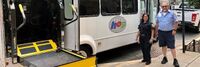
Minneapolis Mobility Hubs | |
| In 2019, the City of Minneapolis launched a mobility hub pilot program to increase access to convenient, low or no carbon transportation options, including transit, shared scooters and Nice Ride bicycles. | ||
|
My Digital Data Locker Baltimore | |
| For those staying in a shelter or shuttling between other people’s homes, keeping track of these vital documents can be near impossible. They also can be lost, destroyed or stolen.
Recognizing that this was blocking some people from securing stable housing, the city of Baltimore this year launched an innovative program — My Digital Data Locker — to help people store and keep track of key documents. | ||
|
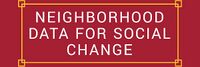
Neighborhood Data for Social Change | |
| The Neighborhood Data for Social Change (NDSC) platform is a free, publicly available online resource for civic actors to learn about their communities. | ||

|
Open Participatory Budgeting | |
| Participatory budgeting (PB) is process in which citizens decide how to allocate part of a municipal or public budget through a process of democratic deliberation and decision-making. Participatory budgeting allows citizens or residents of a locality to identify, discuss, and prioritize public spending projects, and gives them the power to make real decisions about how money is spent. | ||
|
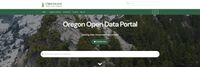
Oregon Data Catalog | |
| The Oregon Data Catalog is a platform for managing and publishing data sets that are relevant to the state of Oregon in the United States. The platform is based on CKAN, which is a free and open-source software platform for managing and publishing data. | ||
|
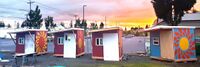
Parkrose Community Village | |
| WeShine’s first micro-village. Micro-villages are “transitional shelters”, designed to provide safety, privacy, hygiene, and community to people seeking permanent housing. PCV will include paid staff, lockable sleeping pods, laundry, showers, toilets, fencing, and a community building. Volunteers will help with art, gardening, financial literacy, food, pet care, and medical/nursing needs. | ||
|
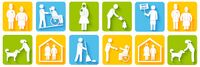
Personal Access System for Services (PASS) | |
| Social services are programs or services designed to support individuals and communities in need. They provide assistance with basic needs such as food, housing, and clothing, as well as health and medical care, education and job training, child care, support for individuals with disabilities or mental health conditions, and aging and elder care. These services are intended to improve the quality of life for individuals and communities and help individuals achieve self-sufficiency. | ||
|
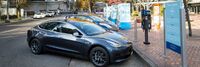
Portland Electric Avenue | |
| Electric Avenue officially opened at the World Trade Center Portland in 2016 and is located on the Northside of Southwest Salmon Street in downtown Portland. It offers street access charging stations to allow visitors to charge their personal electric vehicles while visiting the World Trade Center and neighboring offices. | ||

|
PortlandMaps - Open Data | |
| PortlandMaps delivers site-specific property information, neighborhood crime statistics, aerial photos, school information, and tons of additional map data for the City of Portland and beyond. | ||
|
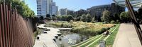
Resilience HUB - East Multnomah | |
| Resilience Hubs are community-serving facilities augmented to support residents and coordinate resource distribution and services before, during, or after a natural hazard event. They leverage established, trusted, and community-managed facilities that are used year-round as neighborhood centers for community-building activities. Resilience Hubs can equitably enhance community resilience while reducing greenhouse gas emissions and improving local quality of life for our communities. They have the potential to reduce burden on local emergency response teams, improve access to public health initiatives, increase the effectiveness of community-centered institutions and programs. | ||
|
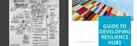
Resilience HUB - NIST Guide | |
| Natural, technological, and human-caused hazards take a high toll on communities, but the costs in lives, livelihoods and quality of life can be reduced by better managing disaster risks. Planning and implementing prioritized measures can strengthen resilience and improve a community's abilities to continue or restore vital services in a more timely way, and to build back better after damaging events. That makes them better prepared for future events and more attractive to businesses and residents alike. | ||
|
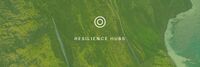
Resilience HUB - Vibrant Hawaii | |
| A goal of the Resilience Hub initiative is to build individual capacity and community networks to be resilient and ready for anything. To get there, Vibrant Hawai'i hosted a Resilience Leadership Academy (RLA) - a monthly development program with curated content by local experts. | ||
|
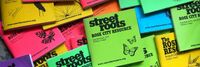
Rose City Resource | |
| The Street Roots Rose City Resource (RCR) is a 4’x 4′, 104 page guide that is the most comprehensive, updated list of services for people experiencing homelessness and poverty in Multnomah, Washington and Clackamas counties. | ||

|
Small Donor Elections | |
| The Small Donor Elections program seeks to reduce the influence of money in politics and encourage election of people to City office who are reflective of and accountable to all Portlanders. | ||
|
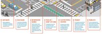
Smart Transit Hubs - B Smart | |
Pilot a smart street light corridor within a system of transit “super-nodes” developed by transforming current major transit stations into transit hubs (Hubs) defined by:
| ||
|
Smart and Accessible Transportation Hub | |
| This GCTC Team aims to systematically investigate a novel cyber-physical infrastructure framework that can effectively and efficiently transform existing transportation hubs into smart facilities. The Smart Hub is capable of providing better location-awareness services (e.g. finding terminals, improving travel experience, obtaining security alters) to the traveling public, especially for the underserved populations including those with visual impairment, Autism Spectrum Disorder (ASD), or simply navigation challenges. | ||
|
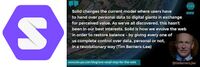
The Solid Project | |
| The Solid project is a decentralized platform for the Web that he and a team of researchers at MIT are developing. The goal of the Solid project is to give people more control over their personal data and how it is used by enabling them to store their data on their own servers or "pods," rather than on centralized servers controlled by companies. | ||

|
Urban Platform | |
| An easy-to-use platform that allows you to manage your city, whether you are responsible for traffic and mobility, safety, infrastructure or high-level decision making. | ||

|
Wabash Heartland Innovation Network - Advancing Agriculture and Manufacturing via IoT | |
| The Wabash Heartland Innovation Network (WHIN) is a consortium of 10 counties in north-central Indiana, funded by the Lilly Endowment, devoted to working together to fuel prosperity by harnessing the power of internet-enabled sensors to develop our region into a global epicenter of digital agricultural and next-generation manufacturing. | ||
|
Wireless Living Lab for Smart Agriculture and Rural Communities | |
* Establish a wireless living lab at an Iowa State University research farm for cross-domain, cross-discipline research, education, and pilot of smart ag and rural connectivity solutions
| ||
The part "]]" of the query was not understood.</br>Results might not be as expected. {{{category}}} {{{tag}}} {{{municipality}}}